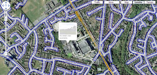
I’ve come across a rather curious anomaly in Google’s new Street View. Southampton is one of the cities covered in the initial UK rollout… or rather, most of Southampton. You’ll note the bizarrely unavailable stretch of Romsey Road… and the odd interruption of Wimpson Lane. Here’s a link to it in Street View, to see for yourself.
So… who do you think operates from this unmapped building? If you need a clue, read this piece I wrote late last year: ‘Ordnance Survey ban Google Maps‘.
Of course, I’m sure there’s a perfectly good reason.

Response
With some cunning pan and zoom action you can just make out their little logo on the sign… if its a determined effort to spoil Google Street View just for the sake of it, then isn’t it a mite poxy? Shouldn’t they spend more time colouring-in contours in the Lake District instead…?